Digitise your maps with over 50+ features all organised into a single workspace.
Create Image, Standard, or Overlay maps and add POIs, labels, and custom info windows. Turn on wayfinding so visitors get turn-by-turn directions, then share your map with a link, embed it on your site, or use QR codes. Manage everything from Map Library and see how visitors use your map in Analytics.
MAP SOLUTION
Who can use Mapiddiction?

Mapiddiction is ideal for private venues and events—festivals, campuses, malls, precincts, zoos, conferences. It fits anywhere that doesn't show well on Google or Apple maps, or where you need custom wayfinding.
MAP SOLUTION
Why choose Mapiddiction?
Mapiddiction gives you a simple builder—no heavy technical setup. Add wayfinding and analytics when you need them.
You get the right balance of power and ease, designed for everyone, not just experts.
Get started with a workspace and digitise your maps. Create as many maps as you need from the same workspace. Need help? Our team is here to assist.
How it works
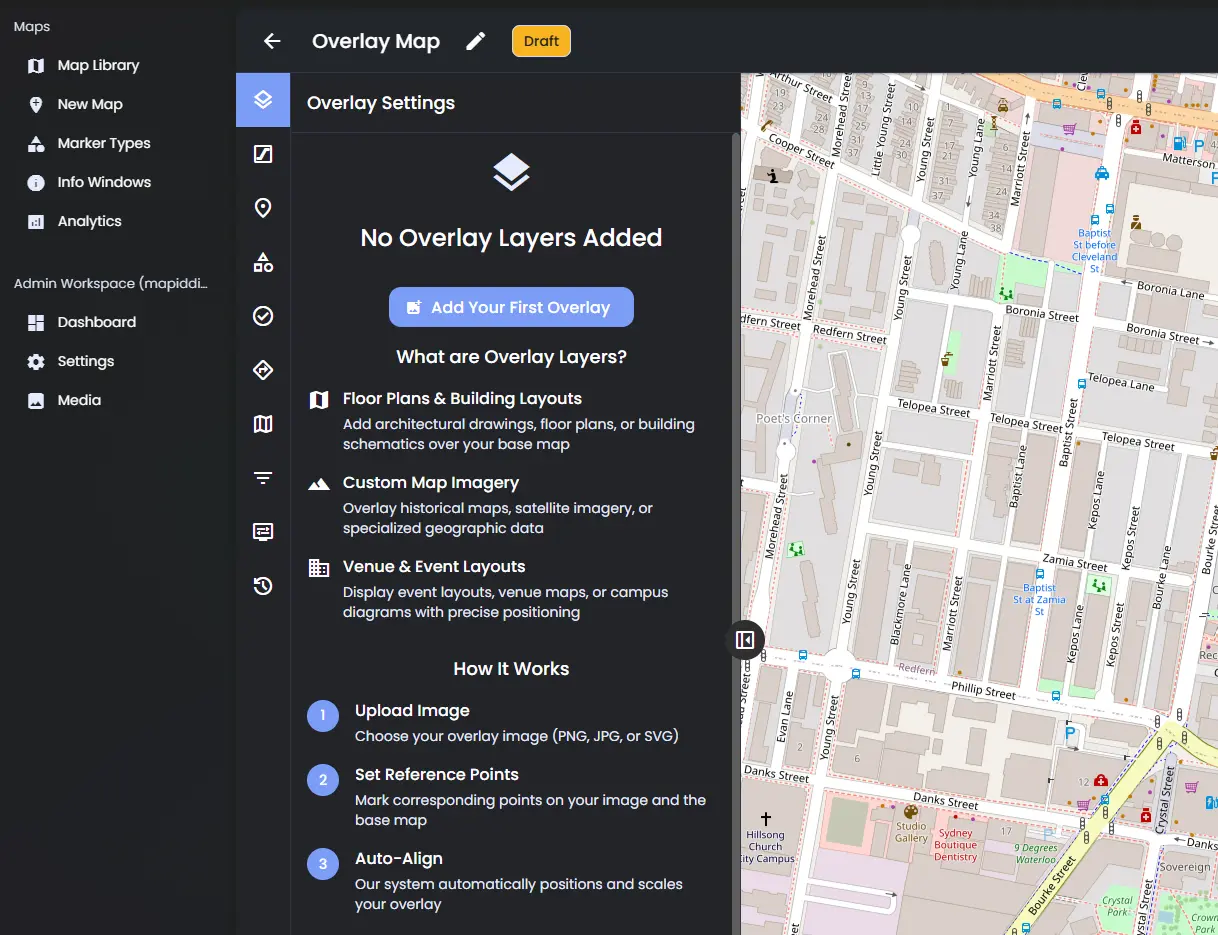
Choose Image Map, Standard Map, or Overlay Map.
*Image = your design only; Standard = base map + POIs; Overlay = your design on a base map.
Upload your design and align it (Overlay or Image) or start from a base map (Standard).
Add points of interest, labels, and info windows. Enable wayfinding if you need directions. Then publish.
ASPECTS
Features Of Mapiddiction
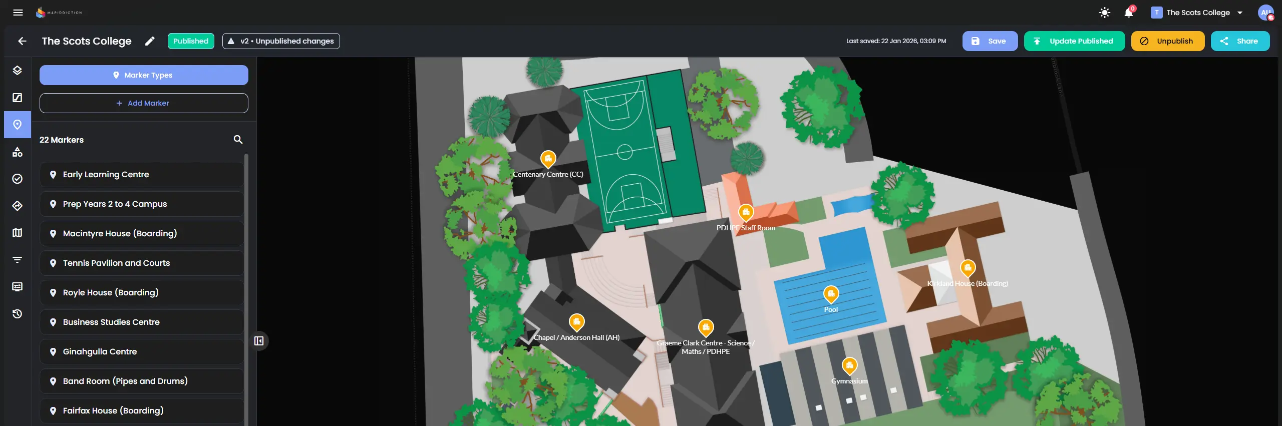
Add markers and shapes, attach images and content. Use reusable Info Window Templates so every POI can have a consistent, custom layout.
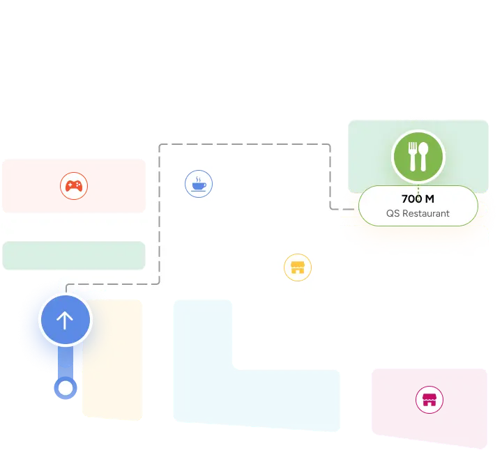
Enable wayfinding on your map. Visitors get turn-by-turn directions from "from" to "to"; optional mobility and route preferences. Share links can open the map with a POI as start or destination.
Public link, embed code for websites, and QR codes for the whole map. Share individual POIs with links that open the map centred on that spot (and optionally open its info window or set wayfinding from/to).
See how your map is used: overview, activity heatmap, device usage, geographic distribution, wayfinding routes, and POI search analytics.
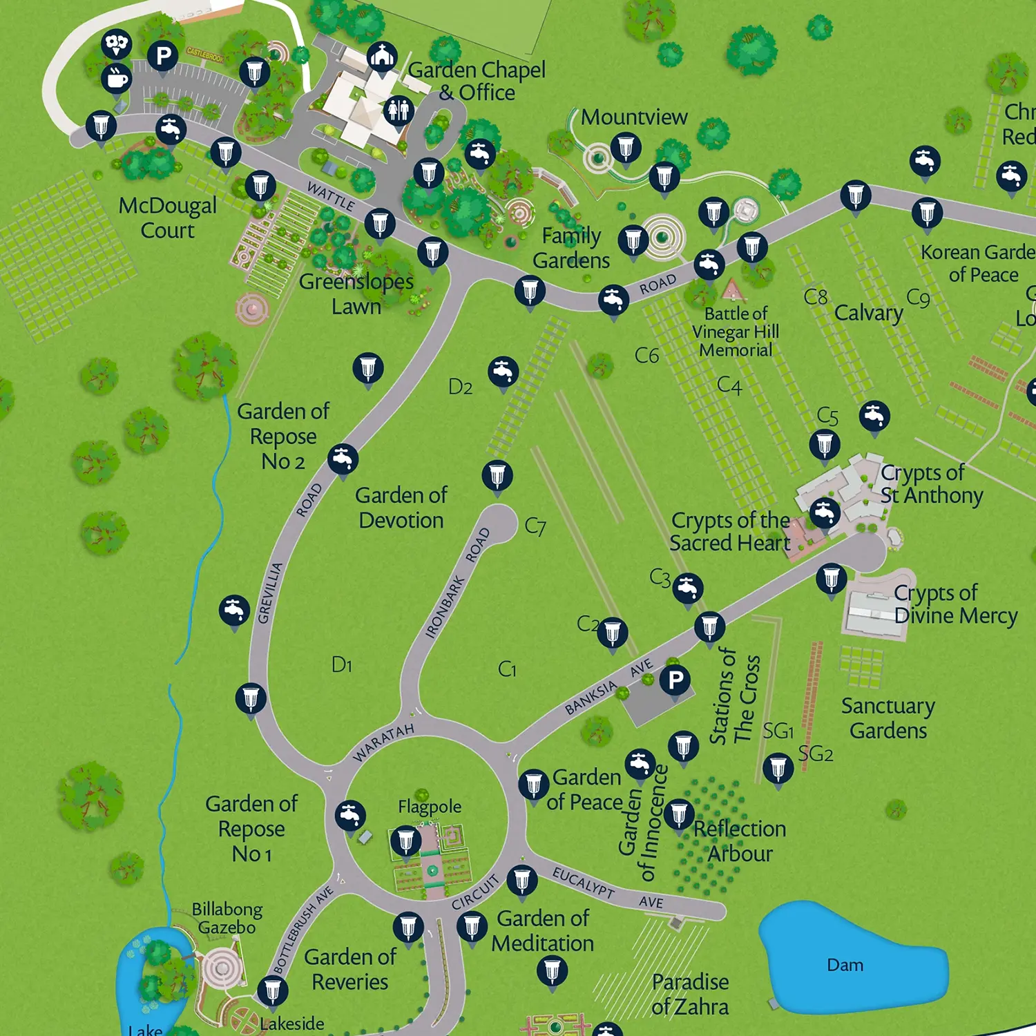
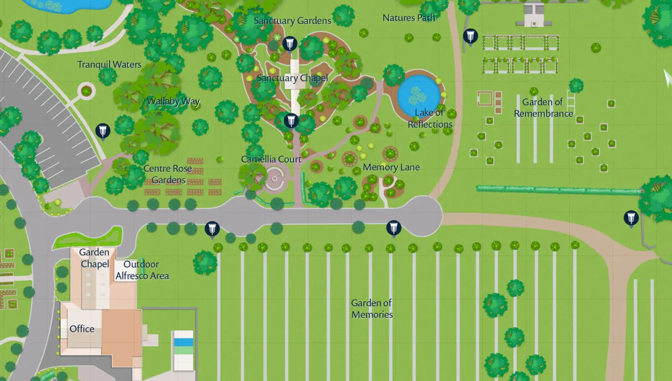
Case study
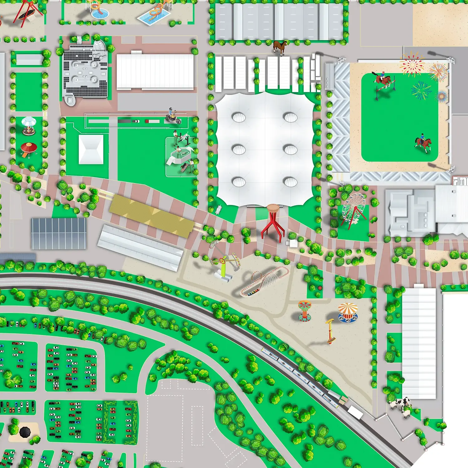
Navigating at Sydney's Royal Easter Show
Sydney Royal Easter Show is the Southern Hemisphere's largest family event. The venue is on Google and Apple maps, but during the event those maps and their wayfinding don't work. Mapiddiction delivered a custom map with turn-by-turn wayfinding so visitors could navigate the show.
Companies we work with